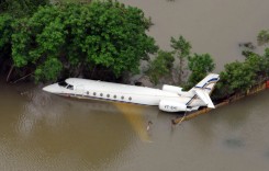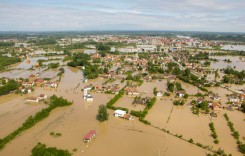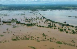
Tropical Cyclone Ita, which has left a swathe of destruction across the south western Pacific Ocean, causing over 20 deaths in the Solomon Islands and devastating sugar cane crops in the northeast of Australia, may yet cause further flooding in New Zealand, according to weather forecasters.
Although ex-Tropical Cyclone Ita is now heading towards New Zealand as a low pressure system, it has been reported that it may combine with a Tasman Low pressure area presently driving heavy rain and showers to the western shores of New Zealand’s South Island. This super-system is then likely to bring heavy rain in the order of 100-200mm (3.9-7.8”) to the North Island and western South Island between Thursday and Friday.
Ita was downgraded from a Category 5 cyclone to a Category 4 cyclone as it made landfall at Cape Flattery on the north Queensland coast on Friday 11 April, then rapidly weakened to a Category 1 storm as it travelled southeastward along the coast.
Satellite rainfall mapping estimated that some of the largest isolated rainfall totals were near 400mm (15.7”) west of both Ingham and Townsville. Doug Fraser of the Australian Bureau of Meteorology reported that 223mm of rain was measured at Copperlode Dam outside Cairns.

Queensland Premier Campbell Newman said the Annan River south of Cooktown burst its banks and flooded the main supply route. He added that ten to fifteen houses had suffered damage in the Kuranda area and 25 to 30 homes in Port Douglas were isolated by flooding. Fortunately there had been no fatalities reported in Australia resulting from Ita.
Ironically, flooding damaged the town water supply infrastructure at Cooktown, with the Council’s CEO, Steve Wilton, warning residents to use water only for “personal consumption and minimal hygiene”, and not to use hoses for any reason.
Queensland Police reported that several people had to be rescued from their vehicles overnight on Saturday, including a truck driver who had a lucky escape after his vehicle was swept off the Bruce Highway by floodwaters south of Cairns.
The Bruce Highway was re-opened to all traffic between Cairns and Townsville early on Tuesday morning, allowing access to the town of Ingham, which had been cut off by flooding on Sunday.
The nearby town of Halifax remains cut off and it is still unclear when the roads will be reopened. There has been minor damage at the Abergowrie bridge.
The Queensland Rail network was closed north of Mackay owing to flooding of the tracks. Inspections cannot be carried out until floodwaters between Townsville and Tully recede.
Flash-flooding and fierce winds caused by Ita were reported by sugar cane growers in far north Queensland to have wiped out about 90 per cent of crops in the region, costing the sugar cane industry tens of millions of dollars, while 95 per cent of the banana plants at a plantation north of Cooktown have reportedly been destroyed, bringing the threat of job losses for the indigenous community of Hope Vale, who depend on the plantation for work.
Tourism operators along the coast are hopeful that the Great Barrier Reef escaped damage as the weather system weakened. The Great Barrier Reef Marine Park Authority has formed an incident response team to assess damage to the reef ecosystem.
“The inner reefs, you’ll see the water will be less clear because of the flow off from the various rivers and creeks. Once we get out to the outer reef areas, we’re very hopeful that there was very minimal damage from the actual cyclone”, said local tourism operator Tony Baker.
“The cyclone went by us just inland. Our indicators were that the wind wasn’t as strong right out on the outer edge of the reef”, he added.
Sources: ABC; Weather Zone; Phys.org; NASA