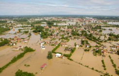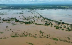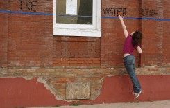
A series of summer storms that began on 26 August brought flash and surface flooding to areas around Cincinnati, Kansas City, Indianapolis, Colorado Springs and Denver in the USA.
Homes were damaged, roads were swamped and in some cases emergency crews were needed to carry out flood rescues. No serious injuries or fatalities were reported. In fact the impact of the floods may seem fairly minor compared to the recent deluge in Louisiana where 13 people died and tens of thousands of homes were damaged. But the recent wave of floods are examples of the types of increased urban flooding that many cities are facing, where localised, intense rain falls in areas that no longer have the ability to absorb rainwater.
Local news station WCPO said described the weekend floods in Cincinnati as:
“Torrents of rain falling from the sky collecting on concrete and asphalt, creating the perfect flash-flood storms.”
Cincinnati
Flooding affected areas of Cincinnati from Sunday 28 August, 2016. Norwood, situated to the north east of Cincinnati, was one of the worst hit areas. Local media reported that St. Bernard and Cincinnati neighbourhoods of Bond Hill, Avondale, Paddock Hills, Oakley and Hyde Park were also affected.
Full damage assessments are yet to be carried out, however it is thought that dozens of homes have been damaged. Some reports said parts of Interstate 71 were under 2 feet (60 cm) of water. Schools have been closed in the area as a result of the floods.
A slow moving storm brought extremely localized heavy rain to some areas, causing the flooding. According to National Weather Service (NWS) in Wilmington, Norwood recorded 4.4 inches (111mm) of rain on 28 August. Yet Cincinnati/Northern Kentucky International Airport, situated around 13 miles (21 km) to the south west of Norwood, recorded just 0.82 inches.
Social Media
Norwood police and fire units responded to a combined approximately 100 emergency incidents tonight during the flooding.
— Norwood Police (@NorwoodPD) August 29, 2016
Flooding now on delta near mt lookout pic.twitter.com/Tv6gvZ5cMD
— Frank Marzullo (@FOX19Frank) August 29, 2016
Video shared w/ us by an NFD firefighter yesterday. NFD responded to back-to-back emergencies 7pm til almost 1am pic.twitter.com/J42FhLWIoe
— Norwood Police (@NorwoodPD) August 29, 2016
Norwood got hit hard by rain! Pics of Elm Ave @NorwoodPolice says responding to lots of flood emergencies @Local12 pic.twitter.com/YsLOWVdfCm
— meghan mongillo (@meghanmongillo) August 29, 2016
Colorado Springs
Heavy rain and hail on Monday 29 August combined to cause surface flooding in Colorado Springs. Roads were quickly swamped and motorists left stranded, with some needing to be rescued by the city’s fire department.
NWS Pueblo issued Flash Flood warnings for Colorado Springs and the surrounding areas during the afternoon of 29 August. NWS reported that 4.11 inches (104mm) of rain was recorded at Peterson, El Paso County, during a 24 hour period between 28 and 29 August, with 2.56 inches (65mm) falling in just a few hours during the afternoon of 29 August.
Heavy rain and hail also flooded streets around the Denver metro area on Tuesday 30 August, according to local media.
Social Media
Heavy rains bring flooding | Don't drive thru running water | car can stall or be washed away -Logan & Bijou area pic.twitter.com/x1KyD5Jcft
— CSFD PIO (@CSFDPIO) August 29, 2016
Logan and Bijou flooding combined with hail. Please avoid area. pic.twitter.com/WwFY2zn3XO
— CSFD PIO (@CSFDPIO) August 29, 2016
⚠️ Move to higher ground! Flash Flood Warning continues for Colorado Springs CO until 4:30 PM MDT pic.twitter.com/sPgU0SiWfA
— NWS Pueblo (@NWSPueblo) August 29, 2016
A look at flooding on Platte just east of Union. #COwx #11storms pic.twitter.com/98Nl0fhqMZ
— KKTV 11 News (@KKTV11News) August 29, 2016
Kansas City
Flooding was reported in the Kansas City area on Friday 26 August. Roads were swamped and vehicles left stranded. Emergency services carried out at least 10 several flood rescues. No injuries or fatalities were reported and the flooding had receded by the next day.
On Friday the National Weather Service issued a flash flood emergency notice for the Kansas City area for Friday night to Saturday morning.
Rain had been falling in the area since Wednesday. Brookside, Overland Park, Olathe and Grandview all recorded over 7 inches (177mm) of rain during the 3 day period since then.
The rainfall increased in intensity in some areas on Friday. NWS said that Downtown Kansas City recorded 4.56″ (115mm) of rain on 26 August, making it the 11th wettest day since records began and making August 2016 the 7th wettest August on record for the city.
The heaviest of the rainfall was localised and fell mostly in the Downtown area. Lee’s Summit, a city just 16 miles (25 km) to the south, recorded just 0.59 inches (14mm) on Friday 26 August.
Social Media
WOW! Flash flooding seen last night in Kansas City, Missouri. Video credit: @KarliRitter #Flooding #MOwx pic.twitter.com/wSdiPfJiXt
— Mark Tarello (@mark_tarello) August 27, 2016
Flooding in Kansas City combined with perfect timing of lightning. Took this at 9:30pm. So many cars were destroyed pic.twitter.com/GdFTFOOWO6
— Patrick Burmester (@Pburm35) August 27, 2016
KC has cracked the Top 10 wettest August on record! More rain in the forecast today and Wednesday. pic.twitter.com/I8NOTGY6mC
— NWS Kansas City (@NWSKansasCity) August 30, 2016
A few more totals from last night's rainfall amounts. pic.twitter.com/1BhzAeMp8A
— NWS Kansas City (@NWSKansasCity) August 28, 2016
Downtown KC measured 4.56" of rain yesterday – making it the 11th wettest day since records began. pic.twitter.com/wufXBGG1EA
— NWS Kansas City (@NWSKansasCity) August 27, 2016
Indianapolis
Friday 26 August also saw flooding in Indianapolis after a storm brought heavy rain and flooding, downed trees and caused power outages.
Flash flood warnings were issued for the Indianapolis areas for 26 to 27 August.
NWS said that 2.40 inches (60mm) of rain fell in Indianapolis during the storm. Streets were flooded and cars were left stranded in roads. Indianapolis Fire Department received 25 calls for high water rescues during a few hours on Friday. No injuries of fatalities were reported.
Flood warnings continued for other areas of the state over the following 48 hours. The City of Muncie recorded around 4 inches of rain on Sunday, 28 August, causing surface flooding.
Social Media
⚠️ Move to higher ground! Flash Flood Warning including Indianapolis IN and Lawrence IN until 9:15 PM EDT pic.twitter.com/6krTiug9Ar
— NWS Indianapolis (@NWSIndianapolis) August 26, 2016
Major street flooding all over the #Indy metro. We can't stress enough: don't drive through high water! Turn Around, Don't Drown! #INwx
— NWS Indianapolis (@NWSIndianapolis) August 26, 2016
#Indy at 6.60" for August precip, now the 8th wettest August on record. Wettest August occurred in 1980 with 8.34". #INwx
— NWS Indianapolis (@NWSIndianapolis) August 27, 2016
Closer to home here's pic of flooding in @CityofMuncie on Madison Street via @WTHRcom FB friend Brandy Arnold #INwx pic.twitter.com/YrdsiQHyfS
— Sean Ash (@SeanWTHR) August 29, 2016
Heavy rain causes flash flooding in #Indianapolis https://t.co/m6cVvvju1k pic.twitter.com/hG0q4lKaD1
— Robbie Dodson (@jodocucimobo) August 27, 2016
Featured image: File photos of flooded cars Photo: U.S. Geological Survey