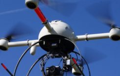
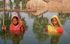
The presence of Unmanned Aerial Vehicles (UAV’s), or ‘drones’ as they are commonly known, has grown exponentially in a wide variety of fields over the last few years, including in the area of humanitarian relief work. The use of UAV’s, however, is not without its controversies. In civilian work, drones are viewed as a blessing by some, and as a bane by others, but one thing is certain, they are here to stay.
Mention of the use or usefulness of drones in disaster relief work has featured in several Floodlist articles over the last three years, including during the Uttarakhand floods, India in 2013, flood monitoring and rescue in Malaysia and in Oklahoma, USA, but there has also been a note of caution expressed.
Potential Problems
Potential problems arising from the use of drones in humanitarian disaster events include the proximity of drones to sites of strategic or military value, proximity to other air traffic, uncoordinated and/or potentially dangerous use of drones (mostly by non-humanitarian agencies or individuals), suspicion of authorities and citizens as to the role of drones, and lack of meaningful cargo carrying capacity.
Following the devastating 2015 earthquake in Nepal, the Nepali Civil Aviation Authority banned the use of drones altogether “as they could leak sensitive information and pictures of valuable heritage sites clicked illegally…which could be misused later”, according to a 6 May 2015 report in the Times of India.
Invasion of privacy is a common concern, even to those in distress, as is danger to other aircraft, but to what extent does the useful role of drones in humanitarian crisis situations make it essential that they continue to be made available?
Regulation
Already much progress has been made in (self-)regulating the use of UAV’s by humanitarian organisations, as well as in the capability and capacity of UAV’s, and also in the logistics of deploying such technology and co-ordinating the compilation of information gathered by them.
At a meeting hosted by the University of Sheffield in England in June 2016, a number of principle stakeholders interested in the use of cargo drones for the delivery of essential humanitarian payloads made presentations focused on cargo drone applications in humanitarian contexts. Included were representatives of UAV and robotics technology developers, humanitarian aid providers and delivery agents, and air traffic control authorities. The initiative was funded by the EC Humanitarian Aid agency ECHO, and was initiated by the Swiss Foundation for Mine Action (FSD) in collaboration with French NGO CartONG, international non-profit organization Zoï Environment Network and the Humanitarian UAV Network (UAViators).
FSD described the meeting as “a combined effort…(to put)…together the most comprehensive knowledge base on the use of drones for humanitarian actors to date”. The purpose of the gathering was “to advance the effective use of this emerging technology in humanitarian efforts actively, responsibly and effectively.”
At the conclusion of the event, it was suggested that the humanitarian community should remain involved in future discussions concerning the application and evolution of cargo drone uses in the development community.
At the meeting, Patrick Meier of WeRobotics outlined the existing International Humanitarian UAV Code of Conduct, which he spearheaded with UAViators, and which was launched in early 2014, with extensive revisions since then.
You can find more about Global UAV Regulations at the FSD database here.
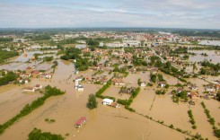
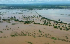
Drones in Flood Monitoring and Humanitarian Work – Case Studies
To shed more light on the status of current drone technology and management in the sphere of humanitarian aid, FloodList will, with the permission of FSD, be publishing a series of case studies relating to the use of drones in flood-related humanitarian work in various parts of the world.
The series will consist of several case studies that are related to flood-relief and reconstruction, including flood-mapping in Tanzania, monitoring flood displaced landmines in Bosnia-Herzegovena, post-disaster mapping in the Philippines and mapping flood and storm damage in Haiti and Vanuatu.
The case studies give a fascinating insight into the range of UAV types available and their different operational applications.
The case studies also highlight the strengths of UAV’s in contrast to other methods such as satellite imagery and piloted aircraft, in each context, as well as the challenges in ensuring that they are used to their full capability, including clearly defined requirements, forms of data capture, co-ordination and communication with authorities and other role-players.