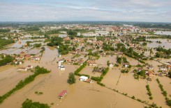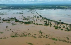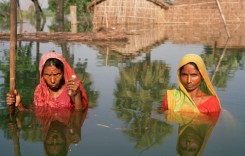
The severe flooding and heavy rain in Nepal and northern India are having a significant impact on river levels downstream in the Indian state of Bihar.
So much so that that at least 100 villages have been flooded in the last 24 hours, according to Bihar’s Disaster Management Department. Crops, transport and communication infrastructure have also been affected. Teams from India’s National Disaster Response Force (NDRF) are working in the area in attempts to ensure safety. Currently the numbers of those who have moved from their homes to safer ground remain in the hundreds. Over 40,000 people were evacuated from their homes after the Nepal landslide earlier in August. The landslide had blocked the Sunkoshi river, raising fears that Bihar would be inundated once the blockage had been removed.
In the northern part of the state, levels of the major rivers, including Kosi, Gandak, Kamla Balan and Bagmati are all extremely high.
In some parts of the rivers have overflowed and inundated nearby villages in 9 districts. The affected districts include: Bagha, Gopalganj, Madhubani, Sitamarhi, Supaul, Saharsa, Khagaria, Darbhanga and Madhepura.
Sadly it seems there is more to come. The heavy rain has persisted in Nepal and the Disaster Management Department expect the situation to worsen over the next 2 days.
Bihar’s Many Rivers
The northern part of the state is host to 8 major rivers – Ghaghra, Gandak, Budhi Gandak, Bagmati, Kamala, Bhutahi Balan, Kosi, Mahananda – all tributaries of the Ganges.

Why Bihar Floods
Bihar has higher, mountainous regions which often bring fast moving flood waters to the lower areas. As shown above, the state is a network of rivers, all of which can easily become raging torrents after heavy rainfall in Nepal. One other major problem is with the Koshi Dam in Nepal. When Nepal suffers from heavy rain, the authorities often open the dam in case it should overload, thus letting the flood waters through to Bihar.