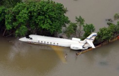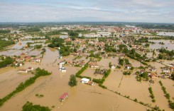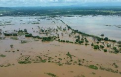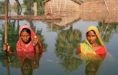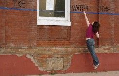
Rangoon and parts of southern Myanmar have seen severe flooding in recent days.
Mynamar was hit by severe flooding in late July 2013. As many as 25,000 people were evacuated after heavy rainfall brought floods to Karen, Mon and Rakhine states. Around 80 relief camps were set up for those displaced. Flooding continued into August in various areas of the country, including Rangoon, but especially in the border regions with Thailand.
Rangoon
A further wave of floods have now hit Mynamar in Arakan, Kayin and Mon states, and yesterday (Thursday 22nd August) much of the city of Rangoon (the commercial capital) was under water. In some areas the water was over 50cm high. Roads were blocked and vehicles came to a standstill as people waded through the streets, as shown in this video clip:
Thandwe, Rakhine
In Rakhine, the coastal town Thandwe (also called Sandoway) suffered floods after torrential rainfall around Sunday 18th August. Thandwe often suffers from flooding around this time of year, due to monsoon rains. However, floods have been getting worse in the last few years – 2004, 2007 and 2011 were notably severe – locals are now blaming poor drainage and over development for the severity of the floods.
Three people drowned in the flood waters, and a further 600 were made homeless after their homes were either flooded or damaged. Heavy rainfall left parts of the town under 1.5 metres of water. It also increased water levels in the Thandwe River, which eventually broke it banks. Food has been distributed to the victims and local authorities have set up 6 relief camps to provide shelter for displaced residents.
[mappress mapid=”79″]
Rice Fields Destroyed
Of concern now is the effect the floods have had on farming and the livelihoods of many of Myanmar’s poorest. For example, the floods have destroyed round 20,000 hectares of paddy field in the in Pyapon Township in the Irrawaddy Delta. About 2,000 hectares were destroyed in Karen state and 250 hectares in Mon State.
Sources: Thai Visa; Relief Web; Irrawaddy