Pacific Rim Countries to Test Their Tsunami Warning System
Countries bordering on the Pacific Ocean are testing their capacity to handle a major tsunami in an exercise from 15 to 17 February, held to identify possible shortcomings in the…

Flood forecasting and early warning systems
Countries bordering on the Pacific Ocean are testing their capacity to handle a major tsunami in an exercise from 15 to 17 February, held to identify possible shortcomings in the…
NASA’s Applied Remote Sensing Training Program is offering a free webinar on the Global Disaster Alert and Coordination System this February. Up-to-date and accessible information is essential to providing an…

World Meteorological Organization (WMO) is working to strengthen forecasting skills for flash floods across the world. WMO’s Flash Flood Guidance System is a major step forward in how local meteorological…
The first ever comparison of six of the major global flood risk monitoring computer models has revealed wide discrepancies between the information they provide. Insurers, risk analysts and many other…
A collaboration between University of Maryland and NOAA demonstrates the suitability of in-orbit datasets for weather satellite calibration. “Traffic and weather, together on the hour!” blasts your local radio station,…
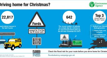
With wet and windy conditions expected from Friday and into the Christmas weekend, the Environment Agency is urging people to check their flood risk – especially if driving or staying…

To better predict tropical cyclone intensity, scientists sponsored by the Office of Naval Research (ONR) recently worked with the National Aeronautics and Space Administration (NASA) and National Oceanic and Atmospheric…
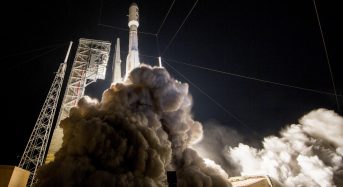
The first of NOAA’s highly advanced geostationary weather satellites lifted off from Cape Canaveral, Florida, on 19 November, 2016. The GOES-R is one of the most advanced weather satellites ever…
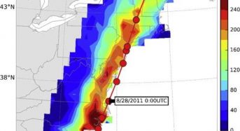
Many people know that tropical cyclones and hurricanes cause high winds and storm surges. But two of their other effects, heavy rainfall and inland flooding, can be just as dangerous…

Flooding in 2016 could be the highest in 50 years, but a web-based forecasting system is alerting people in advance. By Megan Rowling for the Thomson Reuters Foundation. BARCELONA, Sept…
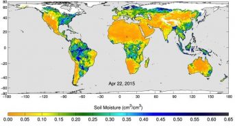
NASA’s Applied Remote Sensing Training (ARSET) Program has announced a further series of its successful online training sessions on using NASA Remote Sensing. This time the training is focused on…
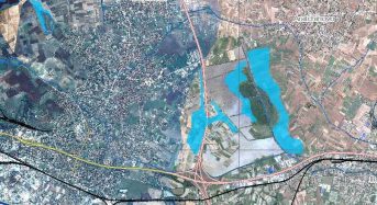
Over the last 15 years, the use of satellite imagery for disaster management support increased significantly, from seven cases in 2000, to 123 in 2014, according to a recent review…

A new report “Assessment of the Early Warning Systems for inland and coastal flooding in Papua New Guinea” was presented on Thursday, 28 April, 2016, by Climate Change Development Authority…
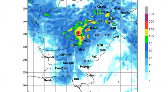
In October 2013, Austin, Texas experienced record levels of flooding. The historic Onion Creek Halloween floods caused several deaths, devastated hundreds of homes, and nearly $30 million in damage. Because…
A new flash flood alert system is set to launch in Oman in July this year. The Oman flash flood guidance system will assist forecasters in their efforts to provide…

Residents motorists along coastal areas of Norfolk, eastern England, will soon benefit from newly installed digital flood warnings signs. The signs will be illuminated when tidal flood alerts and flood…