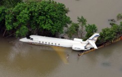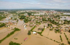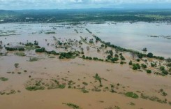
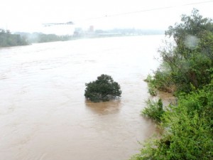
The cities most affected are Porto Alegre, Parobé, Esteio, São Sebastião do Caí, Bento Gonçalves, Cotiporã, Venâncio Aires, Lajeado, Estrela, Colinas, Cruzeiro do Sul, Arroio do Meio, Taquari, Bom Retiro do Sul, Vale Real e Encantado.
Brazil’s Defesa Civil reported that the rivers Antas, Paranhana, Caí, Taquari and Sapucaia Arroyo, all burst their banks after heavy rainfall, resulting in flood waters inundating the homes and streets. Some reports claim the River Taquari is 11 metres above normal levels, at 23.9 metres.
One man is reported missing in San Francisco de Paula after he tried to cross a dam in his car and was swept away by the raging flood waters. Local rescue services are still searching for the man. Another person has been reported injured in a separate incident as a result of the floods.
Map:
[mappress mapid=”87″]
Previous Floods
Rio Grande do Sul is the southernmost state in Brazil, bordered to the north by the Brazilian State of Santa Catarina, to the east by the Atlantic Ocean, on the south by Uruguay, and to the west by Argentina. It is one of the wealthiest states in Brazil and has a population of just over 10 million, covering an area of over 280,000 km². The largest city and state capital is Porto Alegre, Brazil’s southernmost capital, which has a population of 1.5 million.
Floods and landslides recently hit the state of Rio Grande do Sul in 2008 and 2011. In April 2011, as many as 40,000 people were affected by flooding and mudslides after torrential rain. Hundreds were made homeless and around 12 people died. A state of emergency was declared in 7 cities in the state. In November 2008 Rio Grande do Sul was hit hard by flooding, although the bordering state of Santa Catarina suffered worse, where 50 people died and 20,000 were left homeless.
Sources: Globo.com