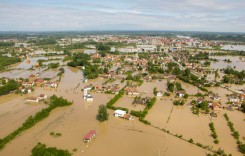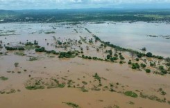
Despite days of preparation for the arrival of Category 5 Super-typhoon Haiyan (referred to as ‘Yolanda’ by meteorologists in the Philippines), early reports indicate at least four people have died in storm-related incidents since its landfall 650km southeast of Manila in the Philippines earlier today, Friday 8 November 2013. Communications with many parts of the country have been disrupted by the weather. The storm was not expected to directly strike the flood-prone capital, but torrential rain was nevertheless reported from Quezon City in Metro Manila at 3:45 local time (07:45UTC).
Accuweather meteorologists warn that Haiyan could bring rain totals up to 200mm along its path, triggering life-threatening flash floods, and in higher terrain localized falls of 250mm to 300mm could occur, raising concerns of severe mudslides. Around 250mm of rain in 24 hours was recorded in Surigao.
Associated Press reported that television images from Tacloban city on the east coast of Leyte Island showed a street under knee-deep flood-water. In a televised address, President Benigno Aquino III stated: “No typhoon can bring Filipinos to their knees if we’ll be united”. He assured the public of preparations being made and warned people to leave high-risk areas, especially 100 villages in the coastal zone, where forecasters predict a storm surge that could reach 7m.
PAGASA Doppler Radar Images
The images below are from Climatex and show the amount of rainfall per hour in 3 regions of the Philippines:
- Subic, Zambales
- Tagaytay, Cevite
- Mactan, Cebu


Weather Channel lead meteorologist has described Haiyan as “a perfectly symmetrical storm with the eye completely clear so it is as strong as you can get”. The Joint Typhoon Warning Centre has reported that it is the strongest typhoon in the world so far this year. Authorities have closed schools, cancelled nearly 200 local flights and restricted ferries and fishing fleets in the path of the storm to port.
At 1pm local time (05:00UTC) the eye of the typhoon was reported by PAGASA to be in the vicinity of Cuartero, Capiz (11.3°N 122.8°E), and by 3pm it was reported to have moved offshore of Tibiao, Antique in Western Visayas (11.3°N 121.9°E). The eye of the typhoon is expected to traverse north of Palawan Island, passing over the strait between Busuanga and Culion Islands before heading westnorthwest over the South China Sea towards the central coast of Vietnam.
Sources: Herald Sun; News Australia; weather.com; NBC; PAGASA DOST, Weather Online Europe; Accuweather